Cemetery Atlas

The Critical Need for Organized Cemetery Documentation
Fragmented records and degrading physical markers put historic cemeteries at risk. Cemetery Atlas provides a practical solution to centralize knowledge and preserve stewardship for future generations.
For municipalities, churches, cemetery associations, and preservation groups, organized records make day-to-day stewardship and future planning easier.
Services
01
Cemetery Mapping & LiDAR
Document cemetery grounds with maps, field photography, and 3D point clouds. We connect visible site features with available records to support preservation and practical stewardship.
02
Records Digitization & Searchable Indexing
Converting paper records into organized, searchable digital information through careful transcription and organized digital files with references to their source records.
03
CAD & Administrative Mapping
Structured spatial mapping for administrative use. While not a legal survey, our digital layouts provide organizations with clear tools for plot management and future planning.
04
Preservation Inventory & Historical Documentation
Comprehensive field documentation of visible features to support long-term stewardship. We assist associations in developing maintenance plans and heritage records for future generations.
LIDAR MAPPING & POINT CLOUDS
Explore the cemetery in three dimensions.
LiDAR captures visible grounds and structures as a detailed 3D point cloud. Move through the reconstruction, rotate your view, and examine the captured site from any direction. Bring monuments, paths, terrain, and their relationships into one navigable record for preservation and planning.
Educational example: Westview Abbey, Atlanta. By Joel Silverman Studio (2024). Third-party demonstration, not a Cemetery Atlas project.
Coverage and deliverables are agreed for each site. Surface documentation is not a legal boundary survey or underground grave detection.
Louisiana Proof of Concept: Carron Cemetery
The Carron Cemetery proof of concept brings mapping and available grave records together to support preservation and practical stewardship. The project map and field photographs shown here document the site’s visible features.
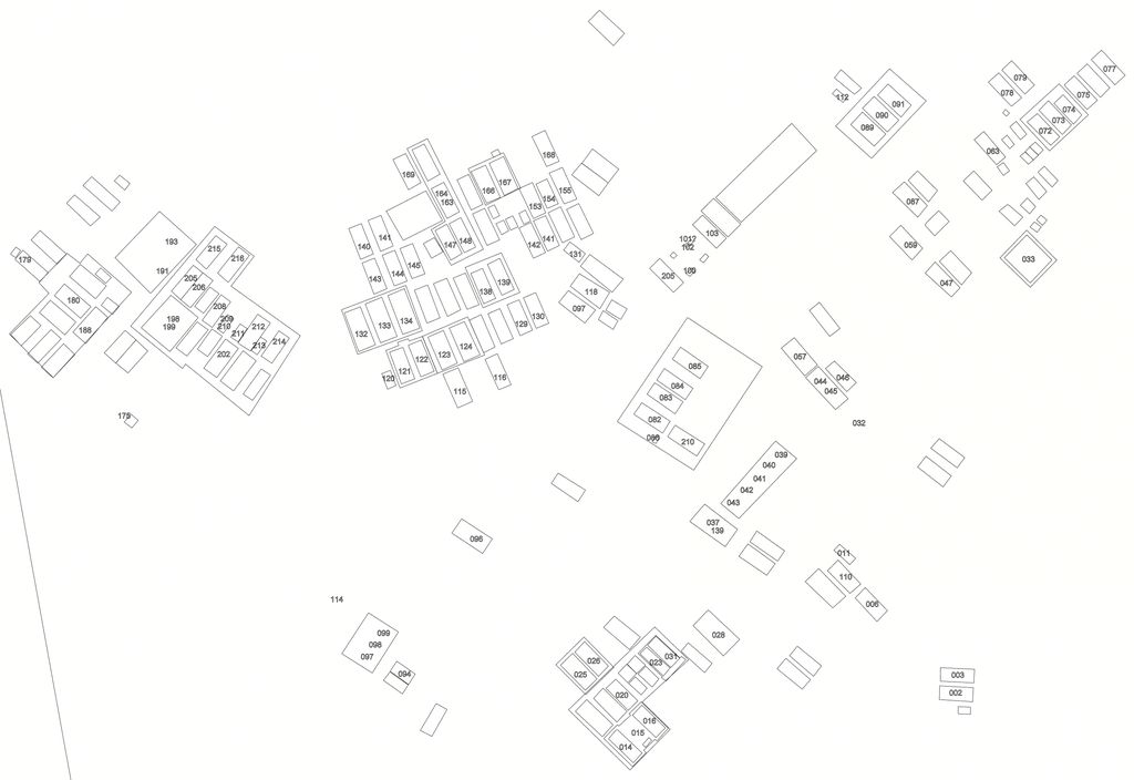
CARRON CEMETERY: PROJECT MAP
Project Deliverables
-
Printable cemetery map
-
Searchable grave index
-
AutoCAD site drawing
-
Organized digital files
-
Field documentation
Note: Surface mapping documents visible features. Non-legal survey documentation.


How It Works
01
Review Existing Records
Review available maps, burial registers, spreadsheets, plot books, photographs, and other source records to understand the information available before field work.
02
Document the Site
Capture photographs and mapping information for the visible features included in the agreed project scope.
03
Reconcile and Organize
Compare field information with available records to identify discrepancies and document what can be confirmed, creating a searchable index with source references and unresolved questions clearly noted.
04
Deliver a Maintainable System
Handing over organized digital archives, maps, and administrative documentation to ensure the long-term stewardship of the historic legacy.
About Cemetery Atlas
Cemetery Atlas is a Louisiana-based preservation and documentation organization built around a practical problem: important cemetery information is often fragmented among physical markers, old records, maps, spreadsheets, and local knowledge. We help preserve that information by turning physical cemeteries and legacy records into organized, practical, maintainable documentation.
Who We Serve
- Municipalities and Parish Governments
- Churches and Religious Organizations
- Cemetery and Family Cemetery Associations
- Historic Preservation and Heritage Organizations
Common Questions
Answers about our methods, project scope, existing records, and getting started.

Start a Project
Every cemetery starts from a different place. Some have paper burial registers. Others have old maps, spreadsheets, incomplete plot records, or very little organized information at all. Tell us what you have and what you need to accomplish. We will review the project and identify a practical next step.